
Austin topographic map
Interactive map
Click on the map to display elevation.
Austin
According to the United States Census Bureau, the city has a total area of 11.90 square miles (30.82 km2), of which 11.79 square miles (30.54 km2) is land and 0.11 square miles (0.28 km2) is water. Its elevation is approximately 1,200 ft (370 m).
About this map
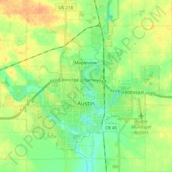
Name: Austin topographic map, elevation, terrain.
Location: Austin, Mower County, Minnesota, 55912, United States (43.64170 -93.04923 43.71334 -92.91901)
Average elevation: 1,227 ft
Minimum elevation: 1,178 ft
Maximum elevation: 1,289 ft
Mower County trails, hiking, mountain biking, running and outdoor activities