
Salem topographic map
Interactive map
Click on the map to display elevation.
About this map
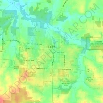
Name: Salem topographic map, elevation, terrain.
Location: Salem, Dent County, Missouri, 65560, United States (37.62699 -91.56396 37.65990 -91.50648)
Average elevation: 1,181 ft
Minimum elevation: 1,099 ft
Maximum elevation: 1,296 ft
Dent County trails, hiking, mountain biking, running and outdoor activities
Other topographic maps
Click on a map to view its topography, its elevation and its terrain.