
Atkins topographic map
Interactive map
Click on the map to display elevation.
About this map
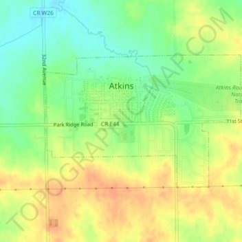
Name: Atkins topographic map, elevation, terrain.
Location: Atkins, Benton County, Iowa, United States (41.98554 -91.87343 42.00033 -91.84401)
Average elevation: 863 ft
Minimum elevation: 794 ft
Maximum elevation: 925 ft
Benton County trails, hiking, mountain biking, running and outdoor activities
Other topographic maps
Click on a map to view its topography, its elevation and its terrain.