
Cape Carteret topographic map
Interactive map
Click on the map to display elevation.
About this map
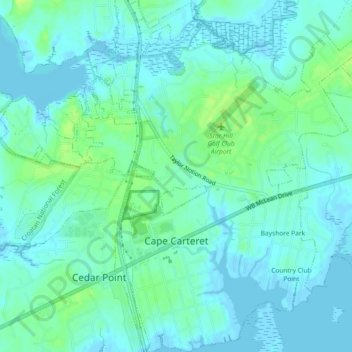
Name: Cape Carteret topographic map, elevation, terrain.
Average elevation: 16 ft
Minimum elevation: -10 ft
Maximum elevation: 46 ft
Carteret County trails, hiking, mountain biking, running and outdoor activities
Other topographic maps
Click on a map to view its topography, its elevation and its terrain.
Sound of the Sea
United States > North Carolina > Carteret County > Emerald Isle
Average elevation: 3 ft
Morehead City
United States > North Carolina > Carteret County > Morehead City
Average elevation: 3 ft
Point Emerald Villas
United States > North Carolina > Carteret County > Emerald Isle
Average elevation: 0 ft
Carolina City
United States > North Carolina > Carteret County > Morehead City
Average elevation: 10 ft