
Salem topographic map
Interactive map
Click on the map to display elevation.
About this map
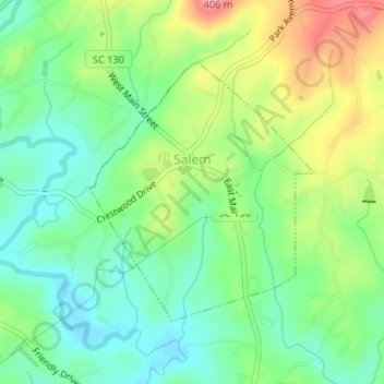
Name: Salem topographic map, elevation, terrain.
Location: Salem, Oconee County, South Carolina, United States (34.87839 -82.98540 34.89662 -82.96607)
Average elevation: 1,037 ft
Minimum elevation: 902 ft
Maximum elevation: 1,263 ft
Oconee County trails, hiking, mountain biking, running and outdoor activities
Other topographic maps
Click on a map to view its topography, its elevation and its terrain.
George Martin Acres
United States > South Carolina > Oconee County > George Martin Acres
Average elevation: 830 ft