
Smethport topographic map
Interactive map
Click on the map to display elevation.
About this map
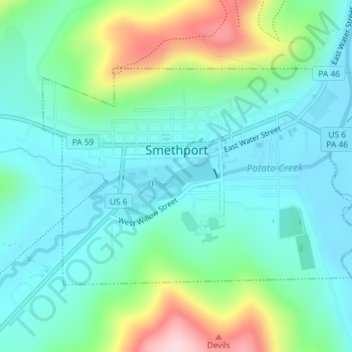
Name: Smethport topographic map, elevation, terrain.
Location: Smethport, McKean County, Pennsylvania, United States (41.79873 -78.46008 41.81534 -78.42700)
Average elevation: 1,667 ft
Minimum elevation: 1,450 ft
Maximum elevation: 2,310 ft
Pennsylvania trails, hiking, mountain biking, running and outdoor activities