
Bowmantown topographic map
Interactive map
Click on the map to display elevation.
About this map
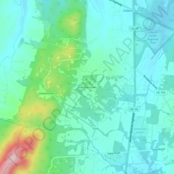
Name: Bowmantown topographic map, elevation, terrain.
Location: Bowmantown, Loudoun County, Virginia, 20105, United States (38.93150 -77.65638 38.97150 -77.61638)
Average elevation: 479 ft
Minimum elevation: 312 ft
Maximum elevation: 1,093 ft
Virginia trails, hiking, mountain biking, running and outdoor activities