
Qutang topographic map
Interactive map
Click on the map to display elevation.
About this map
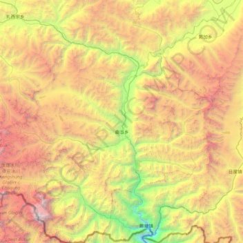
Name: Qutang topographic map, elevation, terrain.
Location: Qutang, Tingri County, Shigatse, Tibet, China (27.82020 86.92483 28.46391 87.61362)
Average elevation: 16,017 ft
Minimum elevation: 7,530 ft
Maximum elevation: 27,467 ft