
Siraha topographic map
Interactive map
Click on the map to display elevation.
About this map
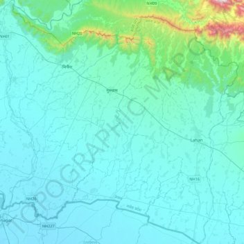
Name: Siraha topographic map, elevation, terrain.
Location: Siraha, Province #2, Nepal (26.54990 86.13113 26.93548 86.55500)
Average elevation: 528 ft
Minimum elevation: 213 ft
Maximum elevation: 3,599 ft
Other topographic maps
Click on a map to view its topography, its elevation and its terrain.