
Fair Play topographic map
Interactive map
Click on the map to display elevation.
About this map
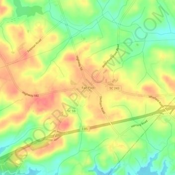
Name: Fair Play topographic map, elevation, terrain.
Average elevation: 764 ft
Minimum elevation: 653 ft
Maximum elevation: 863 ft
Oconee County trails, hiking, mountain biking, running and outdoor activities
Other topographic maps
Click on a map to view its topography, its elevation and its terrain.
Lake Hartwell State Park
United States > South Carolina > Oconee County > Fairplay Shores
Average elevation: 699 ft