
Warrington topographic map
Interactive map
Click on the map to display elevation.
About this map
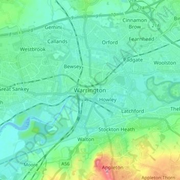
Name: Warrington topographic map, elevation, terrain.
Location: Warrington, England, WA1 1TS, United Kingdom (53.34995 -2.63432 53.42995 -2.55432)
Average elevation: 66 ft
Minimum elevation: 0 ft
Maximum elevation: 341 ft
Other topographic maps
Click on a map to view its topography, its elevation and its terrain.