
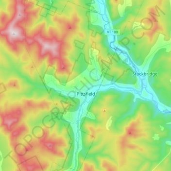
Pittsfield topographic map
Interactive map
Click on the map to display elevation.
About this map
Name: Pittsfield topographic map, elevation, terrain.
Location: Pittsfield, Rutland County, Vermont, 05762, United States (43.71670 -72.87435 43.83963 -72.78286)
Average elevation: 1,706 ft
Minimum elevation: 689 ft
Maximum elevation: 3,297 ft
Vermont trails, hiking, mountain biking, running and outdoor activities