
Phenix City topographic map
Interactive map
Click on the map to display elevation.
About this map
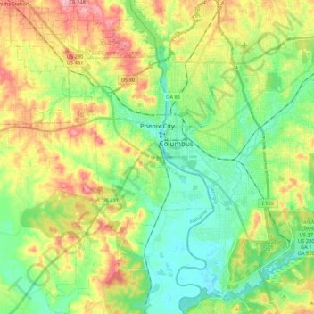
Name: Phenix City topographic map, elevation, terrain.
Location: Phenix City, Russell County, Alabama, United States (32.36023 -85.09384 32.54191 -84.96303)
Average elevation: 358 ft
Minimum elevation: 187 ft
Maximum elevation: 633 ft
Russell County trails, hiking, mountain biking, running and outdoor activities
Other topographic maps
Click on a map to view its topography, its elevation and its terrain.