
Thank you for supporting this site ❤️
Make a donation
Make a donation
Gear up for your next adventure:
As an Amazon Associate, this site earns from qualifying purchases at no extra cost to you.
Đắk Răng topographic map
Click on the map to display elevation.
Thank you for supporting this site ❤️
Make a donation
Make a donation
Gear up for your next adventure:
As an Amazon Associate, this site earns from qualifying purchases at no extra cost to you.
About this map
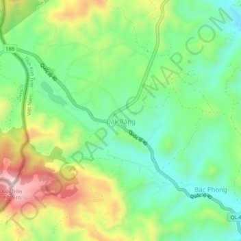
Name: Đắk Răng topographic map, elevation, terrain.
Location: Đắk Răng, Ngoc Hoi District, Kon Tum province, Vietnam (14.67679 107.55526 14.71679 107.59526)
Average elevation: 2,680 ft
Minimum elevation: 2,188 ft
Maximum elevation: 3,524 ft
Thank you for supporting this site ❤️
Make a donation
Make a donation
Gear up for your next adventure:
As an Amazon Associate, this site earns from qualifying purchases at no extra cost to you.