
Altyn-Tagh topographic map
Interactive map
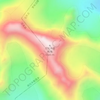
Click on the map to display elevation.
Altyn-Tagh
A series of mountain ranges run along the northern edge of the Tibetan Plateau. In the west are the Kunlun Mountains. About halfway across the south side of the Tarim Basin, the Altyn-Tagh Range diverges northeast while the Kunluns continue directly east, forming a relatively narrow "V". Inside the "V" are a number of endorheic basins. The eastern end of the Altyn-Shan is near the Dangjin Pass on the Dunhuang-Golmud road in far western Gansu. East of the Altyn-Tagh the border range rises to the Qilian Mountains. The range separates the Tarim Basin, to the north, and Lake Ayakkum, to the south. The range can be divided into three portions. The southwest portion borders the Kunlun Mountains, is very rugged, with peaks reaching more than 6,100 metres (20,000 ft) and many perennial snow fields. The central portion is lower in elevation, around 4,000 metres (13,000 ft). The eastern portion is higher in elevation, about 5,000 metres (16,000 ft) and consists of a group of smaller ranges oriented in a south-east to north-west trend.
About this map
Name: Altyn-Tagh topographic map, elevation, terrain.
Average elevation: 19,006 ft
Minimum elevation: 17,635 ft
Maximum elevation: 20,482 ft