
Canlubang topographic map
Interactive map
Click on the map to display elevation.
About this map
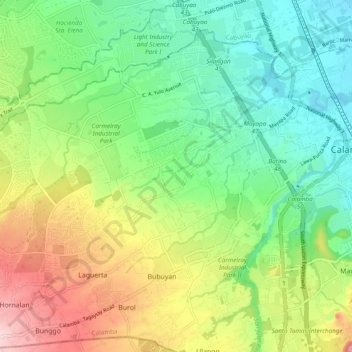
Name: Canlubang topographic map, elevation, terrain.
Location: Canlubang, Calamba, Laguna, Calabarzon, 4028, Philippines (14.16003 121.03123 14.23776 121.12748)
Average elevation: 344 ft
Minimum elevation: 23 ft
Maximum elevation: 915 ft
Other topographic maps
Click on a map to view its topography, its elevation and its terrain.