
Oceanside topographic map
Interactive map
Click on the map to display elevation.
About this map
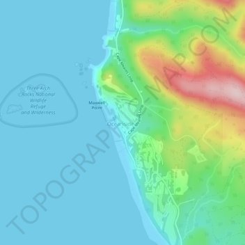
Name: Oceanside topographic map, elevation, terrain.
Location: Oceanside, Tillamook County, Oregon, 97134, United States (45.44216 -123.97487 45.47701 -123.95407)
Average elevation: 200 ft
Minimum elevation: -16 ft
Maximum elevation: 958 ft
Tillamook County trails, hiking, mountain biking, running and outdoor activities