
Shoshone topographic map
Interactive map
Click on the map to display elevation.
Shoshone
According to the United States Census Bureau, the CDP has a total area of 28.7 square miles (74 km2), over 99% of it land. It is 14 miles (23 km) east of Epaulet Peak, at an elevation of 1585 feet (483 m).
About this map
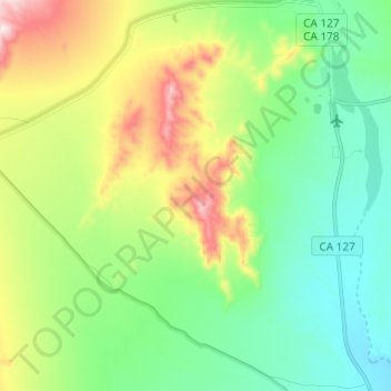
Name: Shoshone topographic map, elevation, terrain.
Average elevation: 1,916 ft
Minimum elevation: 1,355 ft
Maximum elevation: 3,140 ft
CAL Fire San Bernardino Unit trails, hiking, mountain biking, running and outdoor activities
Other topographic maps
Click on a map to view its topography, its elevation and its terrain.