
Jackson topographic map
Interactive map
Click on the map to display elevation.
About this map
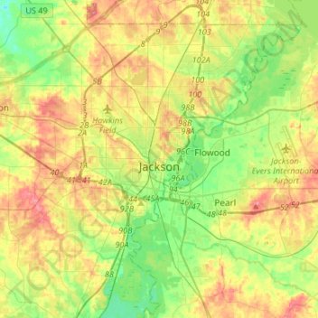
Name: Jackson topographic map, elevation, terrain.
Location: Jackson, Hinds County, Mississippi, United States (32.19550 -90.32993 32.41244 -90.06362)
Average elevation: 315 ft
Minimum elevation: 194 ft
Maximum elevation: 466 ft
Hinds County trails, hiking, mountain biking, running and outdoor activities
Other topographic maps
Click on a map to view its topography, its elevation and its terrain.