
Make a donation
Gear up for your next adventure:
As an Amazon Associate, this site earns from qualifying purchases at no extra cost to you.
Lafayette Square topographic map
Click on the map to display elevation.
Make a donation
Gear up for your next adventure:
As an Amazon Associate, this site earns from qualifying purchases at no extra cost to you.
About this map
Name: Lafayette Square topographic map, elevation, terrain.
Average elevation: 16 ft
Minimum elevation: -16 ft
Maximum elevation: 105 ft
Orleans Parish trails, hiking, mountain biking, running and outdoor activities
Make a donation
Gear up for your next adventure:
As an Amazon Associate, this site earns from qualifying purchases at no extra cost to you.
Other topographic maps
Click on a map to view its topography, its elevation and its terrain.
Lakeview
United States > Louisiana > Orleans Parish > New Orleans
Lakeview is located at 30°00′24″N 90°06′28″W / 30.00667°N 90.10778°W / 30.00667; -90.10778 and has an elevation of 0 feet (0.0 m). According to the United States Census Bureau, the district has a total area of 1.61 square miles (4.2 km2). 1.61 square miles (4.2 km2) of which is land and…
Average elevation: 7 ft
Algiers Point
United States > Louisiana > Orleans Parish > New Orleans > Algiers
Average elevation: 10 ft
Make a donation
Gear up for your next adventure:
As an Amazon Associate, this site earns from qualifying purchases at no extra cost to you.
Make a donation
Gear up for your next adventure:
As an Amazon Associate, this site earns from qualifying purchases at no extra cost to you.
Hollygrove
United States > Louisiana > Orleans Parish > New Orleans > Hollygrove
Average elevation: 7 ft
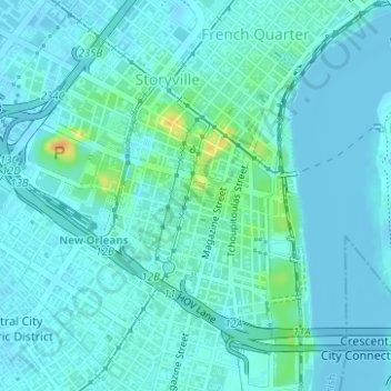
Storyville
United States > Louisiana > Orleans Parish > New Orleans > Storyville
Average elevation: 10 ft
Broadmoor
United States > Louisiana > Orleans Parish > New Orleans > Broadmoor
Broadmoor is located at 29°56′56″N 90°06′15″W / 29.94889°N 90.10417°W / 29.94889; -90.10417 and has an elevation of 2 feet (0.6 m). According to the United States Census Bureau, the district has a total area of 0.56 square miles (1.5 km2). 0.56 square miles (1.5 km2) of which is land and…
Average elevation: 7 ft
Audubon Park
United States > Louisiana > Orleans Parish > New Orleans > Greenville
Average elevation: 13 ft
Make a donation
Gear up for your next adventure:
As an Amazon Associate, this site earns from qualifying purchases at no extra cost to you.