
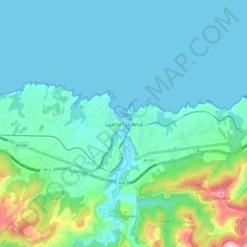
Luarca topographic map
Interactive map
Click on the map to display elevation.
About this map
Name: Luarca topographic map, elevation, terrain.
Location: Luarca, Valdés, Asturias, 33700, España (43.50390 -6.57574 43.58390 -6.49574)
Average elevation: 308 ft
Minimum elevation: 0 ft
Maximum elevation: 1,821 ft
Other topographic maps
Click on a map to view its topography, its elevation and its terrain.
Monte Faro
Monte Faro, Valdés, Asturias, 37790, España
Average elevation: 364 ft
Playa de Barayo
Playa de Barayo, Valdés, Asturias, España
Average elevation: 128 ft