
Bathurst topographic map
Interactive map
Click on the map to display elevation.
About this map
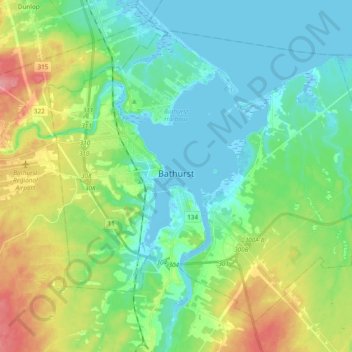
Name: Bathurst topographic map, elevation, terrain.
Average elevation: 85 ft
Minimum elevation: -16 ft
Maximum elevation: 289 ft
Other topographic maps
Click on a map to view its topography, its elevation and its terrain.
Bass River
Canada > New Brunswick > Bathurst
Bass River, Bathurst, Bathurst Parish, Gloucester County, New Brunswick, Canada
Average elevation: 226 ft
Bathurst
Canada > New Brunswick > Bathurst
Bathurst, City of Bathurst, New Brunswick, E2A0C4, Canada
Average elevation: 217 ft