
Bury St Edmunds topographic map
Interactive map
Click on the map to display elevation.
Bury St Edmunds
The name Bury is etymologically connected with borough, which has cognates in other Germanic languages such as the German burg meaning "fortress, castle"; Old Norse borg meaning "wall, castle"; and Gothic baurgs meaning "city". They all derive from Proto-Germanic *burgs meaning "fortress". This in turn derives from the Proto-Indo-European root *bhrgh meaning "fortified elevation", with cognates including Welsh bera ("stack") and Sanskrit bhrant- ("high, elevated building").
About this map
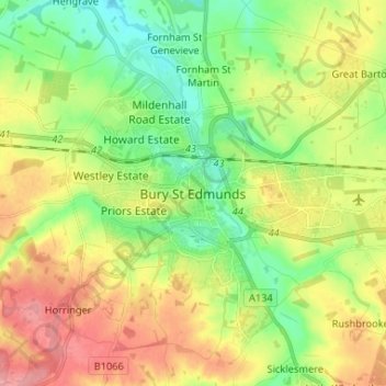
Name: Bury St Edmunds topographic map, elevation, terrain.
Average elevation: 194 ft
Minimum elevation: 69 ft
Maximum elevation: 351 ft