
Shelter Island topographic map
Interactive map
Click on the map to display elevation.
About this map
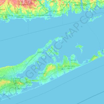
Name: Shelter Island topographic map, elevation, terrain.
Location: Shelter Island, Suffolk County, New York, 11964, USA (40.74454 -72.65286 41.38454 -72.01286)
Average elevation: 26 ft
Minimum elevation: -13 ft
Maximum elevation: 505 ft
Other topographic maps
Click on a map to view its topography, its elevation and its terrain.