
Elkmont topographic map
Interactive map
Click on the map to display elevation.
About this map
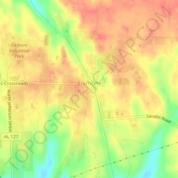
Name: Elkmont topographic map, elevation, terrain.
Location: Elkmont, Limestone County, Alabama, 35620, United States (34.91826 -86.99007 34.93785 -86.96356)
Average elevation: 817 ft
Minimum elevation: 705 ft
Maximum elevation: 873 ft
Limestone County trails, hiking, mountain biking, running and outdoor activities
Other topographic maps
Click on a map to view its topography, its elevation and its terrain.