
Fruitville topographic map
Interactive map
Click on the map to display elevation.
About this map
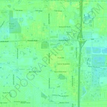
Name: Fruitville topographic map, elevation, terrain.
Average elevation: 33 ft
Minimum elevation: 10 ft
Maximum elevation: 52 ft
Other topographic maps
Click on a map to view its topography, its elevation and its terrain.
Sarasota Heights
United States > Florida > Sarasota County > Sarasota
Sarasota Heights, Sarasota, Sarasota County, Florida, 34239, United States
Average elevation: 23 ft
Sarasota
United States > Florida > Sarasota County > Sarasota
Sarasota, Sarasota County, Florida, 34321, United States
Average elevation: 20 ft
Lido Key
United States > Florida > Sarasota County > Sarasota
Lido Key, Sarasota, Sarasota County, Florida, 34230, United States
Average elevation: 16 ft
Southgate
United States > Florida > Sarasota County > Sarasota
Southgate, Sarasota, Sarasota County, Florida, United States
Average elevation: 33 ft