
Saint John River topographic map
Interactive map
Click on the map to display elevation.
Saint John River
When the Europeans arrived into Wolastokuk, the homeland of the Maliseet Nation and Saint John River basin, they found the locals hunting, gathering, and farming near the banks of the river. European colonists may have used fields and town sites prepared by the natives. Archaeological evidence is that the Maliseet had economic and cultural ties with large portions of North America from their country's homebase within the Wabanaki Confederacy of Dawnland. The Maliseet dealt with freshets by having their village above the floodplain, for example Meductic, while cultivating at a lower elevation where the fields were fertilized by the floodwaters. The Maliseet were highly mobile and the Saint John River was a primary means of transportation.
About this map
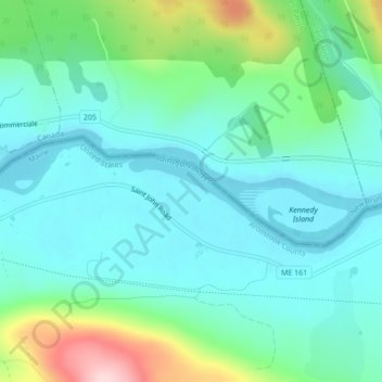
Name: Saint John River topographic map, elevation, terrain.
Average elevation: 682 ft
Minimum elevation: 482 ft
Maximum elevation: 1,342 ft
Aroostook County trails, hiking, mountain biking, running and outdoor activities
Other topographic maps
Click on a map to view its topography, its elevation and its terrain.