
Colfax topographic map
Interactive map
Click on the map to display elevation.
Colfax
Colfax is located in southeastern Washington at 46°53′3″N 117°21′49″W / 46.88417°N 117.36361°W / 46.88417; -117.36361 (46.884033, -117.363668), at an elevation of 1,962 feet (598 m). The nearest cities are Spokane, Pullman, Moscow, and Lewiston/Clarkston. The area is geologically interesting, lying in the midst of the fertile Palouse country in the middle of the Columbia River Plateau, with the Rocky Mountains to the east, the Channeled Scablands to the west, and the Snake River to the south.
About this map
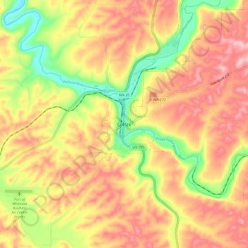
Name: Colfax topographic map, elevation, terrain.
Location: Colfax, Whitman County, Washington, 99111, United States (46.84017 -117.40435 46.92017 -117.32435)
Average elevation: 2,260 ft
Minimum elevation: 1,880 ft
Maximum elevation: 2,556 ft
Whitman County trails, hiking, mountain biking, running and outdoor activities