
De Berry topographic map
Interactive map
Click on the map to display elevation.
About this map
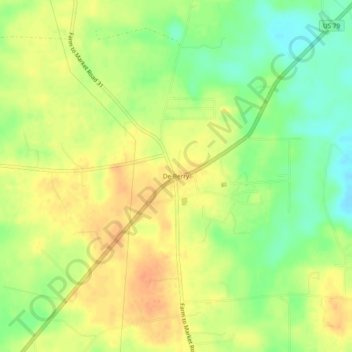
Name: De Berry topographic map, elevation, terrain.
Location: De Berry, Panola County, Texas, 75639, United States (32.28405 -94.18658 32.32405 -94.14658)
Average elevation: 335 ft
Minimum elevation: 262 ft
Maximum elevation: 387 ft
Panola County trails, hiking, mountain biking, running and outdoor activities