
Troy topographic map
Interactive map
Click on the map to display elevation.
About this map
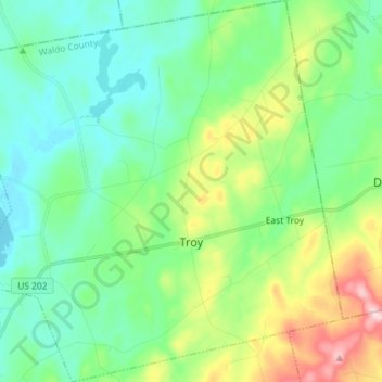
Name: Troy topographic map, elevation, terrain.
Location: Troy, Waldo County, Maine, 04987, United States (44.62713 -69.32741 44.72960 -69.18373)
Average elevation: 400 ft
Minimum elevation: 167 ft
Maximum elevation: 1,043 ft
Waldo County trails, hiking, mountain biking, running and outdoor activities
Other topographic maps
Click on a map to view its topography, its elevation and its terrain.