
Sylva topographic map
Interactive map
Click on the map to display elevation.
About this map
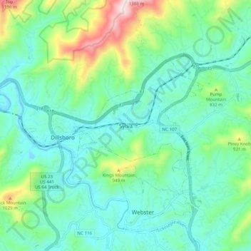
Name: Sylva topographic map, elevation, terrain.
Location: Sylva, Jackson County, North Carolina, 28779, United States (35.33371 -83.26598 35.41371 -83.18598)
Average elevation: 2,411 ft
Minimum elevation: 1,916 ft
Maximum elevation: 4,049 ft
Jackson County trails, hiking, mountain biking, running and outdoor activities