
Lyman topographic map
Interactive map
Click on the map to display elevation.
About this map
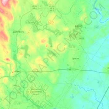
Name: Lyman topographic map, elevation, terrain.
Location: Lyman, York County, Maine, 04002, United States (43.42071 -70.71756 43.58250 -70.56951)
Average elevation: 203 ft
Minimum elevation: 39 ft
Maximum elevation: 492 ft
York County trails, hiking, mountain biking, running and outdoor activities
Other topographic maps
Click on a map to view its topography, its elevation and its terrain.