
Conway topographic map
Click on the map to display elevation.
About this map
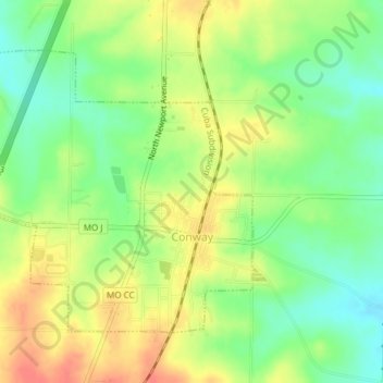
Name: Conway topographic map, elevation, terrain.
Location: Conway, Laclede County, Missouri, United States (37.49447 -92.85278 37.51655 -92.81504)
Average elevation: 1,365 ft
Minimum elevation: 1,280 ft
Maximum elevation: 1,453 ft
Laclede County trails, hiking, mountain biking, running and outdoor activities
Other topographic maps
Click on a map to view its topography, its elevation and its terrain.