
Sanatoga topographic map
Interactive map
Click on the map to display elevation.
About this map
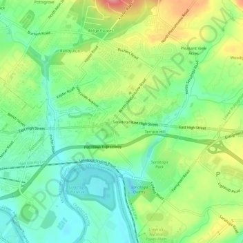
Name: Sanatoga topographic map, elevation, terrain.
Average elevation: 226 ft
Minimum elevation: 102 ft
Maximum elevation: 427 ft
Montgomery County trails, hiking, mountain biking, running and outdoor activities
Other topographic maps
Click on a map to view its topography, its elevation and its terrain.
Sanatoga
United States > Pennsylvania > Montgomery County > Lower Pottsgrove Township > Sanatoga
Average elevation: 279 ft