
Wimberley topographic map
Interactive map
Click on the map to display elevation.
About this map
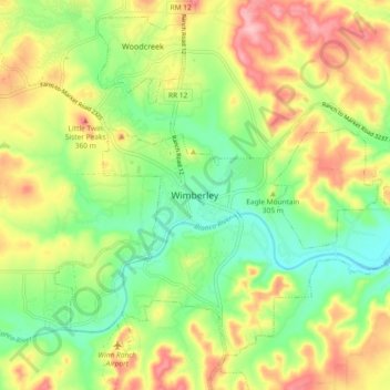
Name: Wimberley topographic map, elevation, terrain.
Location: Wimberley, Hays County, Texas, 78676, United States (29.95768 -98.13879 30.03768 -98.05879)
Average elevation: 988 ft
Minimum elevation: 787 ft
Maximum elevation: 1,243 ft
Hays County trails, hiking, mountain biking, running and outdoor activities