
Briceville topographic map
Interactive map
Click on the map to display elevation.
About this map
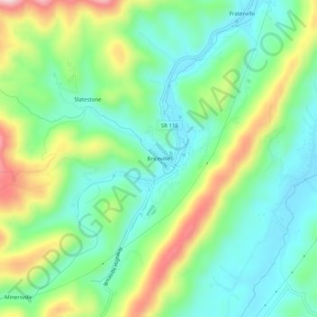
Name: Briceville topographic map, elevation, terrain.
Average elevation: 1,184 ft
Minimum elevation: 866 ft
Maximum elevation: 1,834 ft
Anderson County trails, hiking, mountain biking, running and outdoor activities
Other topographic maps
Click on a map to view its topography, its elevation and its terrain.
Norris Dam
United States > Tennessee > Anderson County > Norris > Norris Park
Average elevation: 1,096 ft