Geolocate

Elbe topographic map

Click on the map to display elevation.

About this map

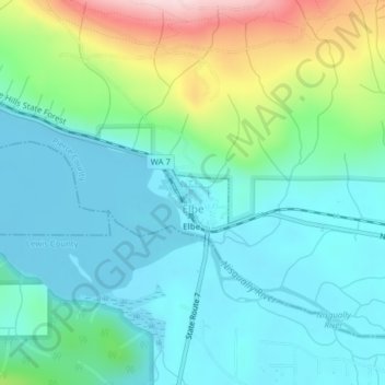
Name: Elbe topographic map, elevation, terrain.

Location: Elbe, Pierce County, Washington, United States (46.76304 -122.19781 46.76848 -122.18991)

Average elevation: 1,440 ft

Minimum elevation: 1,171 ft

Maximum elevation: 2,280 ft

Pierce County trails, hiking, mountain biking, running and outdoor activities

Gear up for your next adventure:

🎒Trekking Poles - Sturdy poles for balance and stability on rough terrain
🧴Hand Sanitizer - Keep hands clean while hiking
🥘Titanium Cookware - Durable, featherlight pots and pans for backpacking
📱Solar Portable Charger - Solar power bank for charging devices off‑grid
🦟Ultrasonic Repellers - Create a bug-free zone at your camp or rest stop

As an Amazon Associate, this site earns from qualifying purchases at no extra cost to you.