
Cornell topographic map
Interactive map
Click on the map to display elevation.
About this map
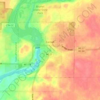
Name: Cornell topographic map, elevation, terrain.
Location: Cornell, Chippewa County, Wisconsin, United States (45.14826 -91.17482 45.17763 -91.10055)
Average elevation: 1,076 ft
Minimum elevation: 942 ft
Maximum elevation: 1,168 ft
Chippewa County trails, hiking, mountain biking, running and outdoor activities
Other topographic maps
Click on a map to view its topography, its elevation and its terrain.
Northern Wisconsin State Fairgrounds
United States > Wisconsin > Chippewa County > Chippewa Falls
Average elevation: 915 ft