
Omaha topographic map
Interactive map
Click on the map to display elevation.
About this map
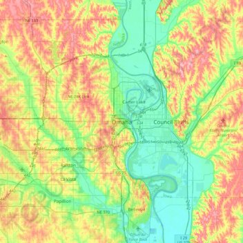
Name: Omaha topographic map, elevation, terrain.
Location: Omaha, Douglas County, Nebraska, 68183, United States (41.09875 -96.09838 41.41875 -95.77838)
Average elevation: 1,112 ft
Minimum elevation: 948 ft
Maximum elevation: 1,352 ft
Douglas County trails, hiking, mountain biking, running and outdoor activities
Other topographic maps
Click on a map to view its topography, its elevation and its terrain.