
Rarden topographic map
Interactive map
Click on the map to display elevation.
About this map
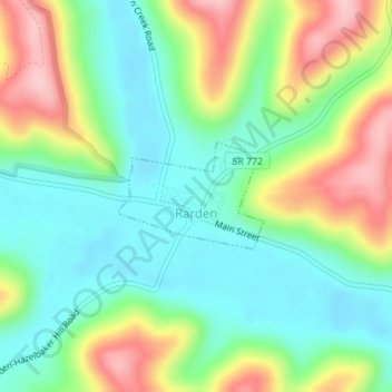
Name: Rarden topographic map, elevation, terrain.
Location: Rarden, Scioto County, Ohio, United States (38.91979 -83.24931 38.92716 -83.23643)
Average elevation: 778 ft
Minimum elevation: 577 ft
Maximum elevation: 1,129 ft
Scioto County trails, hiking, mountain biking, running and outdoor activities