
Roscoe topographic map
Interactive map
Click on the map to display elevation.
About this map
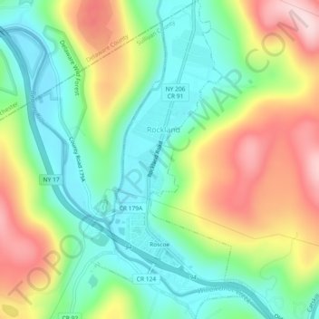
Name: Roscoe topographic map, elevation, terrain.
Average elevation: 1,598 ft
Minimum elevation: 1,227 ft
Maximum elevation: 2,182 ft
Sullivan County trails, hiking, mountain biking, running and outdoor activities
Other topographic maps
Click on a map to view its topography, its elevation and its terrain.
Parkston
United States > New York > Sullivan County > Town of Rockland > Parkston
Average elevation: 1,860 ft