
Thank you for supporting this site ❤️
Make a donation
Make a donation
Gear up for your next adventure:
As an Amazon Associate, this site earns from qualifying purchases at no extra cost to you.
Rome topographic map
Click on the map to display elevation.
Gear up for your next adventure:
As an Amazon Associate, this site earns from qualifying purchases at no extra cost to you.
About this map
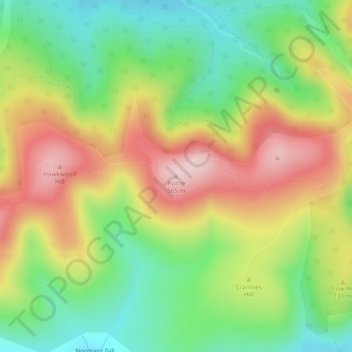
Name: Rome topographic map, elevation, terrain.
Location: Rome, South Lanarkshire, Scotland, ML12 6UD, United Kingdom (55.50059 -3.61751 55.50069 -3.61741)
Average elevation: 1,339 ft
Minimum elevation: 925 ft
Maximum elevation: 1,841 ft
Thank you for supporting this site ❤️
Make a donation
Make a donation
Gear up for your next adventure:
As an Amazon Associate, this site earns from qualifying purchases at no extra cost to you.