
Sonora topographic map
Interactive map
Click on the map to display elevation.
About this map
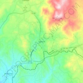
Name: Sonora topographic map, elevation, terrain.
Location: Sonora, Tuolumne County, California, United States (37.94409 -120.42214 38.02409 -120.34214)
Average elevation: 2,073 ft
Minimum elevation: 1,345 ft
Maximum elevation: 3,392 ft
Tuolumne County trails, hiking, mountain biking, running and outdoor activities