
City of Canandaigua topographic map
Click on the map to display elevation.
About this map
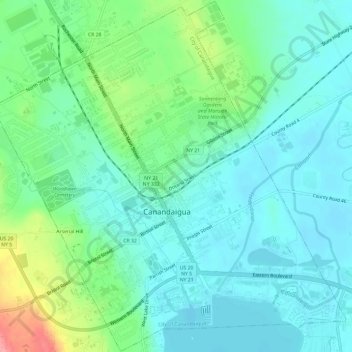
Name: City of Canandaigua topographic map, elevation, terrain.
Location: City of Canandaigua, Ontario County, New York, United States (42.86856 -77.30945 42.91188 -77.24975)
Average elevation: 764 ft
Minimum elevation: 679 ft
Maximum elevation: 1,017 ft
Ontario County trails, hiking, mountain biking, running and outdoor activities
Other topographic maps
Click on a map to view its topography, its elevation and its terrain.