
Nanded topographic map
Interactive map
Click on the map to display elevation.
About this map
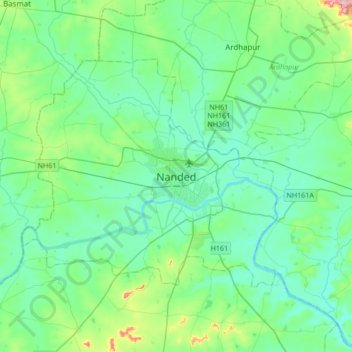
Name: Nanded topographic map, elevation, terrain.
Location: Nanded, Maharashtra, 431600, India (19.00934 77.15101 19.32934 77.47101)
Average elevation: 1,234 ft
Minimum elevation: 1,109 ft
Maximum elevation: 1,791 ft
Other topographic maps
Click on a map to view its topography, its elevation and its terrain.
Nanded
India > Maharashtra > Nanded
Nanded, Nanded district, Maharashtra, India
Average elevation: 1,217 ft