Geolocate

Nanded topographic map

Click on the map to display elevation.

About this map
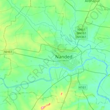
Name: Nanded topographic map, elevation, terrain.

Location: Nanded, Nanded district, Maharashtra, India (19.06889 77.16199 19.27655 77.40834)

Average elevation: 1,217 ft

Minimum elevation: 1,112 ft

Maximum elevation: 1,660 ft

Other topographic maps

Click on a map to view its topography, its elevation and its terrain.

Tuppa

India > Maharashtra > Nanded

Average elevation: 1,207 ft

Gear up for your next adventure:

🧭Map Reading Tools - Tools and kits for map navigation
🧤Tactile Hiking Gloves - Keep hands warm while operating GPS and smartphone screens
🛏️Cold Weather Sleeping Bag - Warm sleeping bag for cold conditions
🥾Women's Hiking Boots - Top-rated trail boots with ankle support and superior grip
🌲Outdoor Survival Books - Best books on survival skills

As an Amazon Associate, this site earns from qualifying purchases at no extra cost to you.