
East Lansing topographic map
Interactive map
Click on the map to display elevation.
About this map
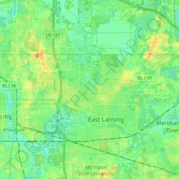
Name: East Lansing topographic map, elevation, terrain.
Location: East Lansing, Ingham County, Michigan, United States (42.69726 -84.51351 42.80098 -84.43887)
Average elevation: 856 ft
Minimum elevation: 810 ft
Maximum elevation: 948 ft
Ingham County trails, hiking, mountain biking, running and outdoor activities
Other topographic maps
Click on a map to view its topography, its elevation and its terrain.
Village of Dansville Community Park
United States > Michigan > Ingham County > Dansville
Average elevation: 948 ft