
Friendswood topographic map
Interactive map
Click on the map to display elevation.
About this map
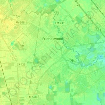
Name: Friendswood topographic map, elevation, terrain.
Location: Friendswood, Galveston County, Texas, 77546, United States (29.45406 -95.23308 29.57296 -95.14692)
Average elevation: 36 ft
Minimum elevation: 7 ft
Maximum elevation: 56 ft
Galveston County trails, hiking, mountain biking, running and outdoor activities
Other topographic maps
Click on a map to view its topography, its elevation and its terrain.
San Luis Pass
United States > Texas > Galveston County > Galveston
Tides cause daily variations in topography, and occasionally, storms more drastically change the topography of the pass.
Average elevation: 0 ft
League City
United States > Texas > Galveston County > League City > League City
Average elevation: 23 ft