
Acadia National Park topographic map
Interactive map
Click on the map to display elevation.
Acadia National Park
The ecological zones at Acadia National Park, from highest to lowest elevation, include: nearly barren mountain summits; northern boreal and eastern deciduous forests on the mountainsides; freshwater lakes and ponds, as well as wetlands like marshes and swamps in the valleys between mountains; and the Atlantic shoreline with rocky and sandy beaches, intertidal and subtidal zones.
About this map
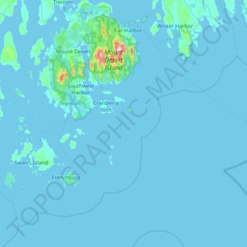
Name: Acadia National Park topographic map, elevation, terrain.
Average elevation: 30 ft
Minimum elevation: -10 ft
Maximum elevation: 1,483 ft
Hancock County trails, hiking, mountain biking, running and outdoor activities
Other topographic maps
Click on a map to view its topography, its elevation and its terrain.
Cadillac Mountain
United States > Maine > Hancock County > Bar Harbor
Cadillac Mountain is located on Mount Desert Island, within Acadia National Park, in the U.S. state of Maine. With an elevation of 1,530 feet (470 meters), its summit is the highest point in Hancock County and the highest within 25 miles (40 km) of the Atlantic shoreline of the North American continent between…
Average elevation: 764 ft