
Thank you for supporting this site ❤️
Make a donation
Make a donation
Gear up for your next adventure:
As an Amazon Associate, this site earns from qualifying purchases at no extra cost to you.
Rotonda-West topographic map
Click on the map to display elevation.
Thank you for supporting this site ❤️
Make a donation
Make a donation
Gear up for your next adventure:
As an Amazon Associate, this site earns from qualifying purchases at no extra cost to you.
About this map
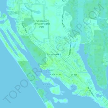
Name: Rotonda-West topographic map, elevation, terrain.
Location: Rotonda-West, Charlotte County, Florida, 33946, USA (26.83784 -82.31482 26.87784 -82.27482)
Average elevation: 7 ft
Minimum elevation: -13 ft
Maximum elevation: 26 ft
Thank you for supporting this site ❤️
Make a donation
Make a donation
Gear up for your next adventure:
As an Amazon Associate, this site earns from qualifying purchases at no extra cost to you.